
Product Gallery Starts with Thermal Mapping Tech Request
BY AsphaltPro Staff
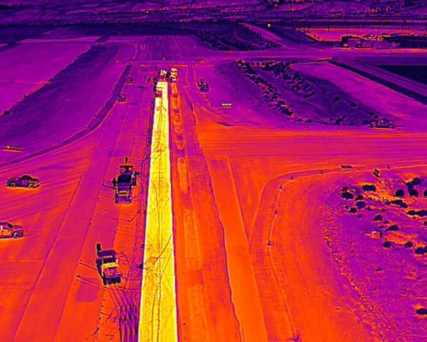
Among the thermal mapping technologies released in the past decade or so are those that assist the paving crew in monitoring mat temperature in real time. Whether these devices are mounted above the paver’s screed, held in the paving foreman’s hand, or incorporated into the rolling train’s intelligent compaction (IC) systems, the industry seeks a way to use mat temperature monitoring to its best advantage. Enter a team from Arizona State University (ASU), Tempe.
Researchers at ASU are developing an automated framework to help asphalt paving contractors improve paving quality by identifying thermal segregation and tracking compaction efficiency in near real time. The patented system, developed by doctoral students Naaga Vedula and Masih Beheshti, under the guidance of Associate Professor Hasan Ozer, Ph.D., (SSEBE), utilizes an unmanned aerial vehicle (UAV) equipped with a thermal sensor. The UAV flies over the active paving site, collecting thermal data to spot temperature segregation in the mat and tracking the precise movement of rollers to assess compaction effort and coverage.
Over the past two years, researchers have visited more than 30 construction projects in Arizona to collect data and train their models. The system can now map the temperature profile of an entire sublot while simultaneously tracking roller movements.
“The main problem contractors face is that by the time segregation or a missed roller pass is discovered, it is often too late for any corrective action on that section,” explained the ASU research team. “Our system can act as an ‘eye in the sky’ that monitors the paved mat and provides near real-time analysis to the paving crew, allowing them to adjust.”
Key benefits for contractors include:
- Identify Segregation: The system automatically identifies thermal segregation and non-uniformities over an entire sublot independent from the paver and displays them on a map for the crew.
- Track Compaction Effort: It tracks roller paths and pass counts, identifying compaction coverage and flagging low-compacted regions.
- Optimize Compaction Window: When fully developed, the system will synchronize mat temperatures with roller activity to inform the paving crew of the remaining time for compaction to be effective.
- Generate Automated Reports: The framework generates quality reports that can be used for QC/QA documentation, helping to ensure projects meet agency specifications.
The ASU team is currently seeking input from asphalt contractors to refine the system and ensure it meets the real-world needs of the industry. You can help the team shape the technology. You are invited to share insights by participating in a short survey at https://asu.questionpro.com/2025-UAV-Survey.
Learn more at https://swpt.asu.edu/projects/construction-quality-monitoring-of-asphalt-pavement-using-unmanned-aerial-vehicle-uav/ or contact Ozer at hasan.ozer@asu.edu.
Astec Introduces EZR3 Rear‑Mount Screed for Enhanced Stability
Fine Stripes Launches in Charlotte to Serve Pavement Marking Needs