Pavo App Simplifies Visual Surveys
BY AsphaltPro Staff

Pavo is a new pavement inspection tool launched November 2020 by Strada Imaging, Wokingham, United Kingdom, that aims to make manual data collection on visual surveys of roads easier.
However, the story behind Strada began more than a decade ago. Strada’s co-founders have been tackling challenges related to transportation infrastructure management for 12 years, through academic research and development on emerging technologies capable of solving key problems. In 2018, Strada Imaging was established to commercialize this work.
A member of Strada’s team was a pavement engineer for years and experienced these challenges first-hand. “It is this problem identification in the first place that led the development of Pavo,” said Strada Managing Partner Senthan Mathavan. In the UK, 80 percent of transportation asset inspection and management is carried out by contractors, so the app is well-suited for both contractors and agencies, he added.
To develop Pavo, Strada Imaging partnered with Aston University, Birmingham, UK.
Pavo aims to improve the pavement inspection process from the start of the project, throughout the inspection, all the way to the sharing of collected data.

Project Settings
Traditionally, the road must be surveyed and measured, drawn up using CAD software, and the inspector takes a printout of the road layout to the job site. “This way, once a layout is printed and the team is at the surveying location things are hard to change, and any new layout observations, hence changes, must be handmarked, potentially leading to confusion,” Mathavan said.
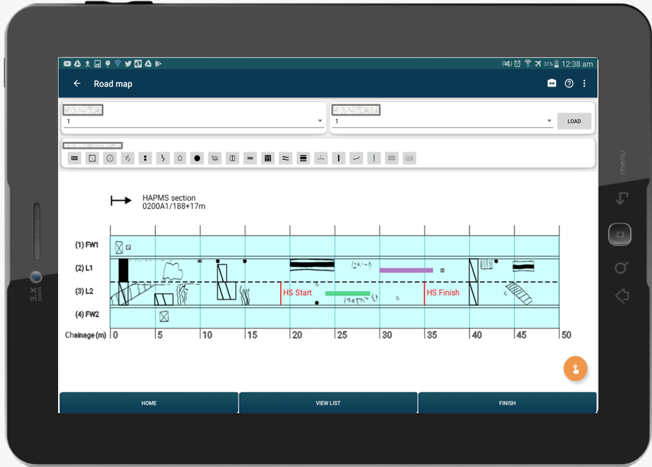
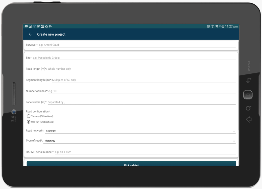
With Pavo, inspectors can visit the survey site on the day of the survey and use Pavo to draw out the layout in less than 10 minutes. On Pavo’s project set-up page, users can create road maps with different lane numbers and types, traffic flow directions, or divided into segments of different lengths. Because the map is digital and always accessible within Pavo, the road layout can also be changed after the survey has started.
Inspection Process
The traditional way of performing manual road inspections is with pens, paper, and a number of other tools such as a camera, measuring wheel and flashlight. “This can make data entry quite cumbersome,” Mathavan said.
Instead, Pavo users take notes directly on their tablet or smartphone. Pavo also makes use of the device’s in-built camera, GPS and other sensors. This eliminates the need to carry most other inspection equipment, except for a surveyor’s wheel in instances requiring higher positional accuracy than that of a GPS.
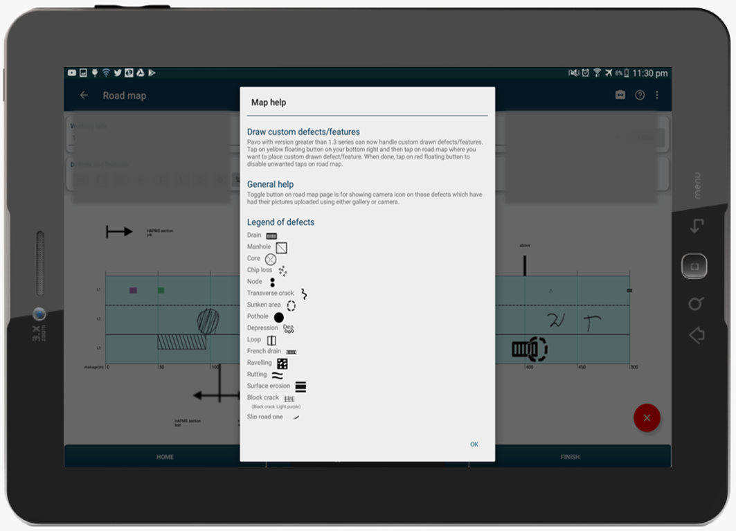
The app contains a number of common road defects for fast recording and also allows users to draw defects as needed. “Surveyors can continue their old practices on paper, such as drawing or scribbling, but now all in the digital world,” Mathavan said. This process makes it possible to edit and update defects, if required.
The drawing feature was a suggestion by UK-based Asset Management Group of Jacobs, which field-tested the app for 10 months. “We can now draw and write literally anything into the app directly,” said Jacobs Senior Pavement Engineer Ryan Johnson.

He also appreciates that inspections via tablet work better at night and in inclement weather: “Pen and paper surveys are always at the mercy of the elements, often leaving survey sheets with illegible records due to smeared ink from rain,” he said. “With Pavo, we can simply turn off the tablet’s screen and wipe it dry before continuing.”
Strada Imaging has also developed an equivalent version of Pavo for vehicle-based manual road inspections, or windshield surveys. The app can also work with or without access to the internet, another feature suggested by early users. For work in areas with lack of coverage, the work can be performed and all data will be uploaded to the cloud once a connection has been established.
TRB Releases “Standard Definitions for Common Types of Pavement Cracking”
Exporting & Sharing Data
Another key feature of Pavo is that it eliminates the need to digitize paper-based notes. At the end of a survey, its report can be created and emailed to anyone, Mathavan explained. This includes emailing project files, as well as CSV and PDF report generation, at the click of a button.
“Automated digitization, report generation, and emailing–all performed instantaneously–massively cut down the time and effort we usually spend on post-processing, when we are back in office,” Johnson said. “Pavo brings a breath of fresh air to our visual inspections.”
Since Pavo’s launch, several contractors and agencies are either trialing or using the app in the UK. Now, Strada Imaging is looking to expand use of the app to other markets, including the United States.
The app is currently available via Google Play. Mathavan added that they are offering a two-week free trial of Pavo. “Some form of manual pavement survey takes place in every geography, and since our app is very flexible in its recording capabilities, we are trying to market widely right from the very start.”
Strada plans to release an iOS version of the app in 2021.
